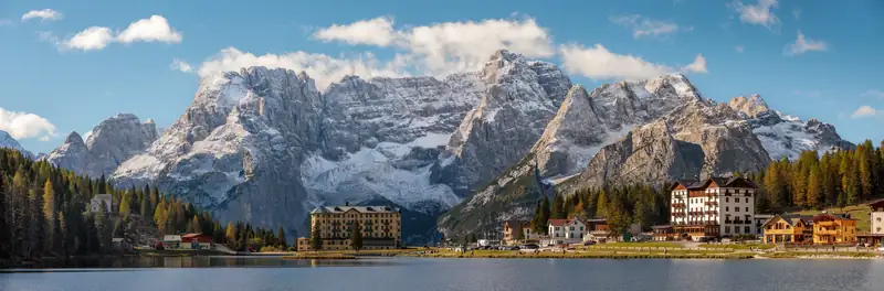
The best hikes in the Dolomites near Misurina are the Tre Cime loop (about 10 km, 3 to 4 hours), the short Cadini di Misurina viewpoint walk and the Lake Sorapis trail (10.5 km, 4 hours, with exposed ledges). Farther away, the Seceda ridge, the Cinque Torri and the Lago di Braies loop are the classics.
This page does not try to rank every trail in the Dolomites. It starts with the hikes you can reach from Lake Misurina in minutes, which happen to include some of the best known in the range, then adds a few famous ones farther afield. Every distance and time below comes from the tourism boards, Wikivoyage or named walking guides.
Dolomites hikes at a glance
| Hike |
Start |
Distance |
Time |
Climbing |
Difficulty |
| Tre Cime loop |
Rifugio Auronzo |
About 9.5 to 10 km loop |
3 to 4 h |
About 400 m |
Moderate (CAI grade E) |
| Cadini di Misurina viewpoint |
Rifugio Auronzo |
About 3.9 km return |
1 to 1.5 h |
About 145 m |
Easy, exposed final section |
| Lake Sorapis |
Passo Tre Croci |
10.5 km return |
About 4 h |
About 430 m |
Hard: ladders, cabled ledges |
| Monte Piana |
Misurina (jeep shuttle) |
Plateau paths |
2.5 to 4 h |
Varies |
Varies by path |
| Lake Misurina loop |
Misurina |
About 2.6 km |
30 to 60 min |
About 20 m |
Easy |
| Seceda ridge |
Seceda lift, Val Gardena |
1 km ridge; about 9 to 10 km loop |
1 h; 3 to 4 h |
About 440 to 520 m (loop) |
Easy to moderate |
| Lago di Braies loop |
Braies lakeshore |
About 3.5 to 4 km |
1 to 1.5 h |
About 100 m |
Easy |
| Cinque Torri |
Cinque Torri chairlift top |
About 1.9 km loop |
About 1 h |
About 130 m |
Easy |
| Lago Federa |
Ponte de Ru Curto, Passo Giau road |
About 10 km return |
3 to 4 h |
About 350 to 500 m |
Moderate |
Climbing figures are totals for the whole route where sources give them. Grade E is the Italian Alpine Club (CAI) mark for an ordinary hiking path.
Hikes near Misurina
1. Tre Cime di Lavaredo loop
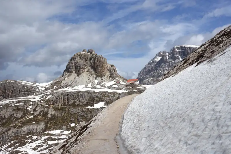
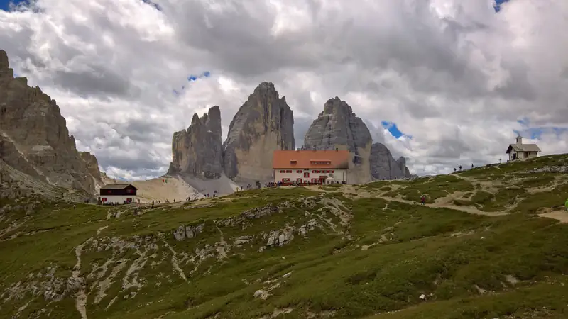
The best-known hike near Misurina: the toll road to its start took about 110,000 vehicles in 160 days in 2025, according to SiViaggia. From Rifugio Auronzo, at the end of the toll road above Misurina, you walk anticlockwise round the three peaks: trail 101 east past Rifugio Lavaredo to Forcella Lavaredo (2,454 m, the high point), on to Rifugio Locatelli for the north faces, then back on trail 105 past Malga Langalm. dolomiti.it gives 9.5 km, about 3 hours and 400 m of climbing; Wikivoyage allows about 4 hours for an average walker.
Getting to the start is the part to plan. In 2026 the toll road cost €40 per car with a mandatory online booking, and the Dolomitibus shuttle from Misurina cost €10 a day per person. The Rifugio Auronzo guide covers both, and the Tre Cime guide has the full route.
2. Cadini di Misurina viewpoint
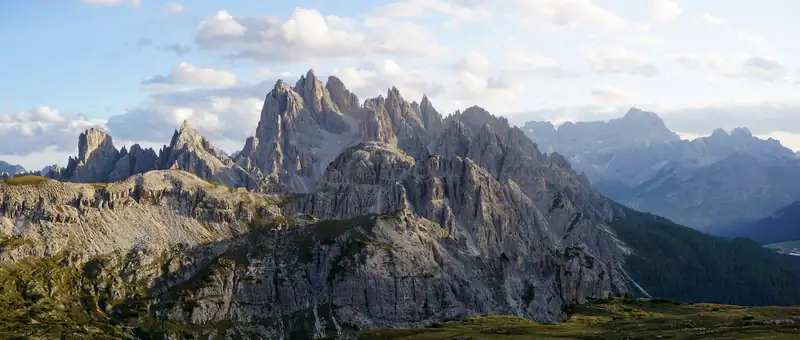
From the same car park at Rifugio Auronzo, trail 117 heads toward Rifugio Fonda Savio and the viewpoint over the Cadini spires. Walking guides give about 3.9 km return, 30 to 35 minutes each way and about 145 m of climbing. The last bit is exposed and loose, so skip it in the wet or if you get vertigo. Pair it with the Tre Cime loop on the same toll-road ticket. Details are in the Cadini di Misurina guide.
3. Lake Sorapis
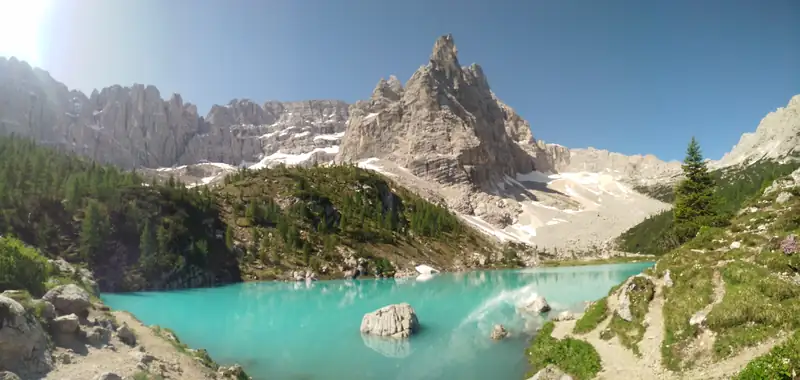
Trail 215 starts at Passo Tre Croci, 6 km from Misurina toward Cortina, and ends at a turquoise lake below the Sorapiss. Cortina’s tourism board gives 10.5 km return, 4 hours and about 430 m of total climbing, and rates it For Experts: after a flat forest start the path crosses metal ladders and an exposed ledge fitted with steel cables. Parking at the pass fills early in summer.
If drops bother you, trail 217 from Val d’Ansiei reaches the lake with no exposed sections, at the cost of a steeper climb. The Lake Sorapis guide has both routes.
4. Monte Piana
The flat-topped mountain just north of Misurina was on the front line in the First World War, and its plateau is now an open-air museum of trenches and tunnels around Rifugio Bosi (2,205 m). The road up is closed to private cars. In 2026 a jeep shuttle ran from the Genzianella restaurant in Misurina from 1 June to 31 October, at €25 return (checked October 2026), or you can walk up trail 122 from Lago d’Antorno in about 2.5 hours. Allow 2.5 to 4 hours to walk the plateau. The Monte Piana guide has more.
5. Lake Misurina loop
Not a mountain hike, but the right first walk on arrival or the last one after a long day. The flat path round the lake is about 2.6 km and takes 30 minutes to an hour, partly on wooden footbridges, with the Sorapiss above the south shore. Go at sunset, after the tour groups have left. More in the Lake Misurina guide.
Famous hikes farther away
6. Seceda ridge, Val Gardena
Seceda is a ridge above Val Gardena, about 80 km west of Misurina (allow 2 hours by car). A cable car climbs from Ortisei, and from the top station the ridge path leads to the summit cross at 2,519 m. Val Gardena’s tourism board says the ridge itself is about 1 km and takes about an hour with photo stops.
One catch since 2025: going east from the summit cross on trail 6 toward the Pana saddle passes a €5 paid gate, put up by the landowners. The tourism board points out that the views do not need that section, and trail 1 runs just below the ridge as the alternative. A popular longer loop carries on via Pieralongia to Col Raiser: about 9 to 10 km and 3 to 4 hours in walking guides.
7. Lago di Braies loop
The shore path round Lago di Braies is about 3.5 to 4 km and takes 1 to 1.5 hours. The west shore is flat; the east shore climbs over steps. From 1 July to 15 September 2026, cars needed a booking to enter the valley between 9:00 and 16:00. Braies is about 35 km from Misurina. See the Lago di Braies guide for the rules, buses and boats.
8. Cinque Torri
The five rock towers sit above the Passo Falzarego road west of Cortina, about 40 minutes’ drive from Misurina. A chairlift from Bai de Dones takes you to Rifugio Scoiattoli at 2,255 m, and in 2026 it ran from 6 June to 11 October. From the top, a loop of about 1.9 km and an hour (Earth Trekkers) winds through restored First World War trenches and gun positions, part of an open-air museum. Adding Rifugio Averau (2,413 m) and Nuvolau (2,575 m) takes another 1.5 to 2.5 hours. There is a guided version from Cortina in the tours below; things to do in Cortina d’Ampezzo covers the town itself.
9. Lago Federa and the Croda da Lago
From Ponte de Ru Curto on the road from Cortina to Passo Giau, trails 437 and 434 climb through forest to Lago Federa at about 2,040 m, with Rifugio Croda da Lago beside the water. Walking guides give about 2 hours up and 350 to 400 m of climbing to the lake, or 5 to 6 hours for the full Croda da Lago circuit. The car park at the start is small and free.
Choosing a hike
- One day, no car: stay at Misurina and take the shuttle to Rifugio Auronzo for the Tre Cime loop and the Cadini viewpoint.
- Bad with heights: the Cinque Torri trenches, the lake loops, or Sorapis by trail 217, which has no exposed sections.
- With young children: Lake Misurina, Lago di Braies or the Cinque Torri trenches.
- A big day out: Sorapis by the 213 and 215 loop, or the Seceda to Col Raiser loop.
For when to go, see the best time to visit the Dolomites, and for the lakes you pass along the way, the Dolomites lakes guide. If you would rather hike with a local guide, the tours below start from Misurina or Cortina, and the tours page has the full list.