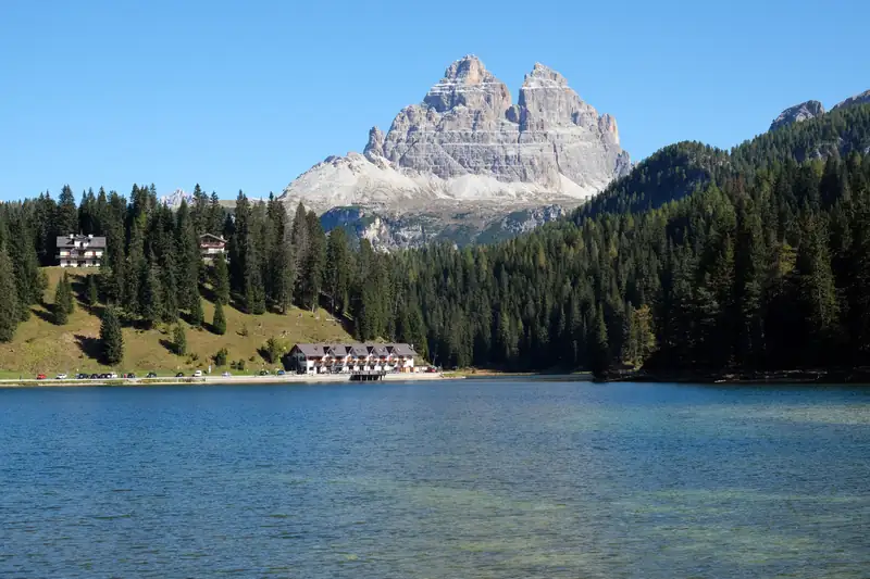
The best-known Dolomites lakes are Braies, Sorapis, Carezza and Misurina. Lake Misurina makes a good base for them: Lago d'Antorno is 2 km away, the Sorapis trail starts 6 km south, and Braies, Landro and Dobbiaco are within about 40 minutes by car. Braies limits cars in high summer, and Sorapis is a 2-hour hike each way.
This guide covers nine Dolomites lakes you can reach in a day from Lake Misurina, from roadside lakes you can walk around in half an hour to Sorapis, which takes a 2-hour hike each way. Most of them sit in the eastern Dolomites between Cortina, Misurina and Dobbiaco, and one, Carezza, is a longer drive west.
Dolomites lakes at a glance
| Lake |
Area |
How to reach |
Best for |
| Lake Misurina |
Misurina, Auronzo di Cadore (Veneto) |
Road; parking on the shore |
An easy 2.6 km walk, a base for the Tre Cime |
| Lago d’Antorno |
2 km north of Misurina |
Tre Cime road; Dolomitibus shuttle stop |
Tre Cime reflected in the water |
| Lago di Braies |
Prags valley, South Tyrol |
Road, booking needed 1 Jul to 15 Sep, 9:00 to 16:00 |
The boathouse view, rowing boats, a 1-hour lake loop |
| Lago di Sorapis |
Sorapiss group, near Cortina |
Hike only, about 2 h each way from Passo Tre Croci |
Turquoise water, a proper mountain hike |
| Lago di Landro (Dürrensee) |
Val di Landro, on the SS51 |
Road, 9 km from Misurina |
A quick stop with a Tre Cime view |
| Lago di Dobbiaco (Toblacher See) |
South of Dobbiaco, South Tyrol |
Road; 2.5 km nature trail from the car park |
Families, buggies, birdwatching, a summer dip |
| Lago Federa |
Below the Croda da Lago, Cortina |
Hike only, about 2 h up from the Passo Giau road |
A forest hike to a lake with a hut beside it |
| Lago di Carezza |
Eggental, below the Latemar |
Road; bus 180 from Bolzano |
Colours and reflections, a 20-minute stroll |
| Lago di Santa Caterina |
Auronzo di Cadore |
Road, below Misurina |
A stop on the way up from Venice |
1. Lake Misurina
Lake Misurina sits at 1,754 m in a hamlet of Auronzo di Cadore, with the Sorapiss above its south shore and the Cadini di Misurina to the east. Both Italian and English Wikipedia call it the largest natural lake in Cadore. The flat path around it is about 2.6 km and takes 30 minutes to an hour, partly on wooden boardwalks.
Be ready for a lower lake than in older photos. A leak in the south-shore wall, found in 2022, has lowered it, and a winter with little snow made 2026 worse: on 21 July 2026 the council put the water 84 cm below the spillway. Our Lake Misurina guide covers the walk and everything else at the lake.
2. Lago d’Antorno
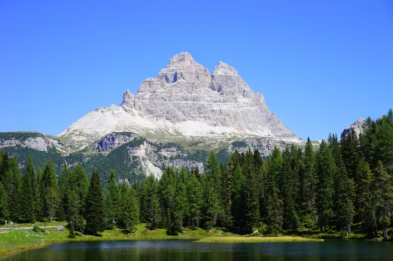
This small lake at about 1,866 m lies 2 km north of Misurina beside the toll road to the Tre Cime. The official Auronzo tourism site picks it out for the reflection of the Tre Cime in its water: the classic reflection photo is taken here, not at Misurina. An easy loop path goes round it, and the Dolomitibus shuttle from Misurina to Rifugio Auronzo stops here in summer.
If you are driving up to the Tre Cime di Lavaredo, you pass it anyway.
3. Lago di Braies
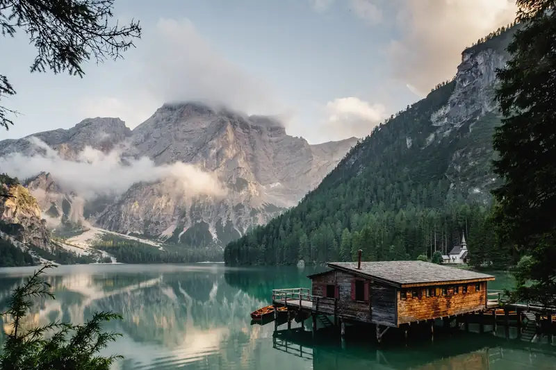
Braies (Pragser Wildsee) is the boathouse lake, 1,496 m up in South Tyrol and about 35 km from Misurina. A landslide dammed the valley to form it, and it reaches 36 m deep. The shore loop is about 3.5 to 4 km and takes 1 to 1.5 hours, and you can hire wooden rowing boats from late April to the start of November.
From 1 July to 15 September 2026, cars needed an online booking or transit permit to enter the valley between 9:00 and 16:00, and the buses had to be booked too. Read the Lago di Braies guide before you go in summer.
4. Lago di Sorapis
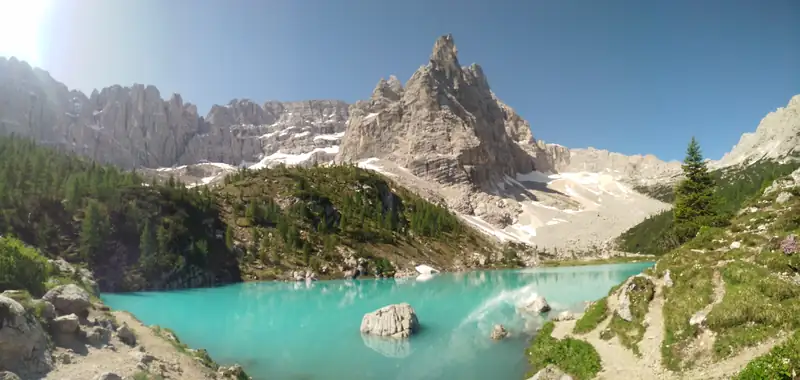
The milky-turquoise lake below the Sorapiss gets its colour from glacial rock dust. You reach it on trail 215 from Passo Tre Croci, 6 km from Misurina: Cortina’s tourism board gives 10.5 km return and 4 hours, and rates it For Experts because of metal ladders and exposed ledges with cables. Rifugio Vandelli stands beside the lake.
It is shallow, about 3.5 m at its deepest, and in July 2026 it was about 2 m down after a dry winter. Swimming is not allowed. The Lake Sorapis hike guide has the route, the exposure and a way round it.
5. Lago di Landro (Dürrensee)
The lake lies at about 1,406 m beside the SS51 in the Val di Landro, the valley that runs from Carbonin north to Dobbiaco. The Tre Cime view is not from the shore itself but from the Vista Tre Cime (Drei-Zinnen-Blick) viewpoint about 1 km north. An easy path loops round the lake, about 3.6 km and an hour, and the steep Pionierweg up to Monte Piana starts here: 3 to 4 hours of partly exposed climbing.
It is about 9 km from Misurina, on the way to Braies or Dobbiaco, so it costs you nothing to stop. The Cortina Winter Polo began on its ice in 1989 before moving to Misurina.
6. Lago di Dobbiaco (Toblacher See)
The lake lies south of the town of Dobbiaco (Toblach), about an hour’s walk from the centre and about 17 km from Misurina. The Three Peaks regional tourism board describes a 2.5 km nature trail with 11 information stations that takes under an hour and works with a pushchair. There are pedal boats and rowing boats, and in spring and autumn the shore vegetation draws waterfowl and migratory birds; the observation deck is on the west shore.
It is also the lake on this list where the tourist board says bathing is popular in summer. Of all nine, it is the gentlest for small children.
7. Lago Federa
Lago Federa sits at about 2,040 m under the jagged ridge of the Croda da Lago, with Rifugio Croda da Lago beside it. The usual start is Ponte de Ru Curto on the road from Cortina up to Passo Giau, which has a small free car park. Trail 437, then 434 from Cason di Formin, climbs about 350 to 400 m through forest to the lake in roughly 2 hours.
The figures come from walking guides rather than an official source, so treat them as approximate. Fit walkers can extend it into the full Croda da Lago circuit, 5 to 6 hours. See the best hikes in the Dolomites for how it compares with Sorapis.
8. Lago di Carezza
Lago di Carezza (Karersee) is the outlier on this list: about 100 km west of Misurina, 2 hours or more by car. It sits at 1,520 m in the Eggental below the Latemar, and the Latemar and Rosengarten reflect in the water. Its Ladin name, Lech de l’ercaboan, means rainbow lake.
It is a protected natural monument. A fence keeps you off the shore, and swimming and skating are banned. Underground springs feed it, so the size changes: in wet summers and snowy winters it can reach about 300 m long and 22 m deep, and at other times it is much smaller. The short circuit from the car park is 1.3 km, about 20 minutes. Bus 180 runs from Bolzano and from Val di Fassa, and the car park cannot be booked.
Carezza fits better into a trip based in Bolzano or Val di Fassa than a day out from Misurina. For a longer trip, see the Dolomites itinerary.
9. Lago di Santa Caterina (Auronzo)
The long lake in the town of Auronzo di Cadore is an artificial reservoir, bigger than Misurina but not natural. You pass it on the road up from the south, and several Venice day trips stop at the Auronzo dam on the way to Misurina.
Seeing several lakes in a day from Misurina
Misurina sits in the middle of the eastern lakes, which makes a lakes day easy by car:
- Lago d’Antorno first thing, 2 km up the Tre Cime road.
- North on the SS51 to Lago di Landro (about 9 km).
- On to Lago di Dobbiaco (about 17 km from Misurina).
- West along the Val Pusteria to Lago di Braies, timed around the booking window in July to mid-September.
- Back to Lake Misurina for an evening walk.
That is roughly 70 km of driving in total, about 75 minutes at the wheel by routing estimates, more in summer traffic. Sorapis and Federa each need most of a day on their own because of the hike.
Without a car, the simplest option is a lakes day trip from Venice. The ones below all stop at Misurina for at least an hour, and two of them add Braies. Our Venice to the Dolomites guide compares them with the bus, and the tours page lists every trip we checked.