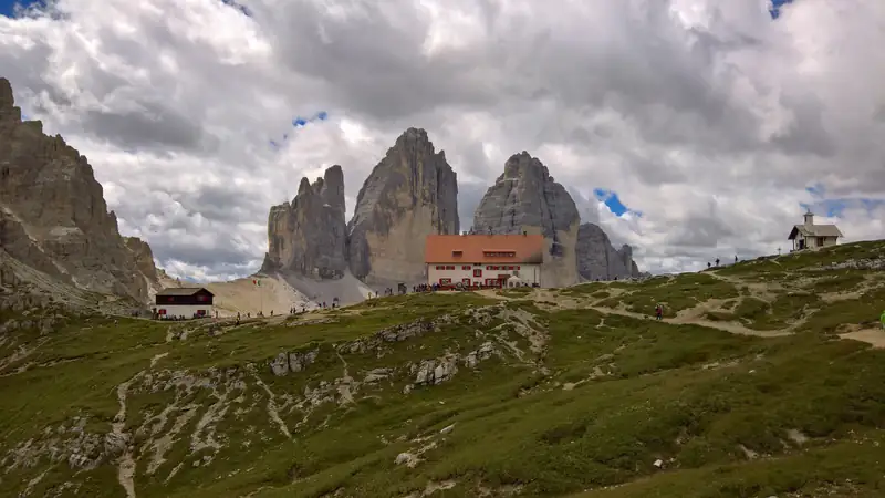
Tre Cime di Lavaredo: hiking the loop from Misurina
The Tre Cime di Lavaredo loop is a walk of about 9.5 km and 400 m of climbing around three peaks, taking most people 3 to 4 hours.
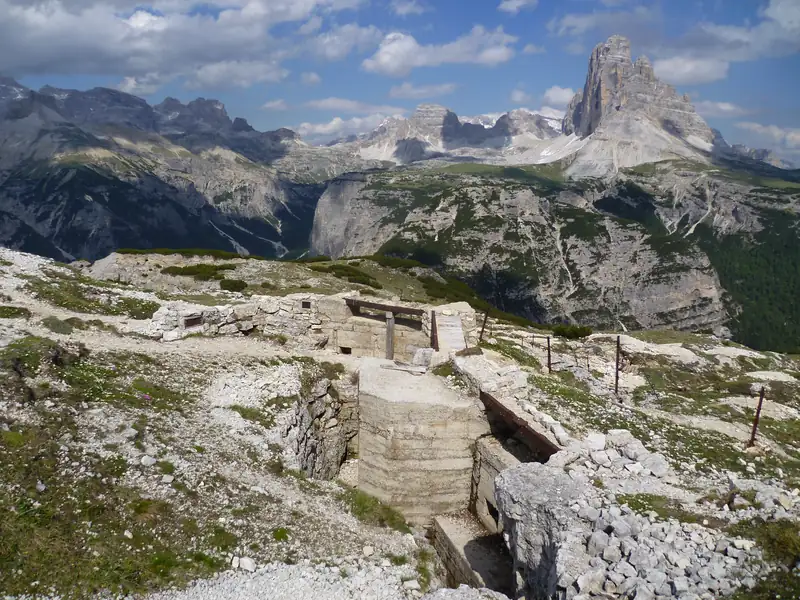
Monte Piana is a mountain plateau about 4 km north of Lake Misurina where Italian and Austro-Hungarian troops faced each other from 1915 to 1917. Its trenches and tunnels are now a free open-air museum. A jeep shuttle from Bar Genzianella reaches Rifugio Bosi in about 12 minutes; on foot from Lago d'Antorno, allow about 2.5 hours.
Monte Piana is a broad mountain plateau about 4 km north of Lake Misurina. Italian and Austro-Hungarian troops held its two ends from 1915 to 1917, and their trenches, tunnels and gun posts are now a free open-air museum. From the lake, a jeep shuttle reaches Rifugio Bosi (2,205 m) in about 12 minutes. Walkers need about 2.5 hours from Lago d’Antorno.
The plateau has a 360-degree view: the Tre Cime, Monte Paterno, the Cadini, Sorapiss, Cristallo and Lake Misurina below.
The road up is a partly paved municipal road built on the old military road, cut into the rock in its upper part. It has been closed to traffic since 1998, bicycles included. You have three ways up.
The jeep shuttle. Jeeps leave from the Ristorante Bar Genzianella on Via Monte Piana, about 0.9 km from the centre of the lake, the same spot as the Dolomitibus stop for the Tre Cime shuttle. They run at least every 20 minutes and take about 12 minutes to Rifugio Bosi. You buy tickets at the departure point and cannot book.
Trail 122 from Lago d’Antorno. A 4.8 km hiking path graded E climbs to the plateau in about 2.5 hours. The car park at Antorno is small and, according to hiking blogs, fills early on Sundays; the Lake Misurina parking guide covers the alternatives. Walkers who follow the old military road instead share it with the jeeps.
From Lago di Landro. The Pionierweg (trail 6) climbs the north side past the middle station of an old military cableway. It is steep, partly exposed and rated for experienced hikers; a helmet is advised for falling rock. Published times range from 2 hours 45 minutes to 4 hours.
Checked October 2026:
| Route or service | Time | Climb or fare |
|---|---|---|
| Jeep shuttle, Bar Genzianella to Rifugio Bosi | About 12 min, 5 km | €17 one way, €25 return per person |
| Shuttle season and hours (2026) | 1 June to 31 October, 9:00 to 17:00 | No booking, at least every 20 min |
| Trail 122, Lago d’Antorno to the plateau | About 2.5 h up | 4.8 km, graded E |
| Pionierweg (trail 6), Lago di Landro to the plateau | 3 to 4 h up | Steep, exposed in places, experienced hikers only |
| Museum circuit from Rifugio Bosi | 2.5 to 4 h | Little extra climbing |
| Rifugio Bosi to the south summit | About 20 min | About 1 km, 120 m up |
Rifugio Bosi closed for the season on 27 September 2026, while the shuttle page still advertised runs until 31 October. Whether the jeep actually ran in October 2026 is not confirmed, so phone the operator before an autumn visit. Contact details are on montepiana.com.
The museum covers the plateau: restored trenches, tunnels, gun positions and other wartime remains. Volunteers have been bringing them back to light since the late 1970s, starting with Austrian colonel Walther Schaumann and the Dolomitenfreunde (Friends of the Dolomites), and later the Fondazione Monte Piana and the Associazione Amici del Monte Piana.
There is no single route or ticket. Walk from Rifugio Bosi and allow 2.5 to 4 hours depending on how much you want to see. The extra climbing is small, but some points are reached only over exposed, secured spots. Stay on the marked paths, and keep children close there.
The weather changes fast on the open plateau, so carry a layer even on a warm day at the lake.
On 24 May 1915, the day Italy entered the war against Austria-Hungary, two platoons of Alpini from the Pieve di Cadore battalion occupied the summit. For the next two and a half years Italian troops held the southern summit, Monte Piana, and Austro-Hungarian troops the northern one, Monte Piano.
Italian troops dug a mine tunnel about 200 m long under the Austrian positions on Monte Piano. The blast was planned but never fired. The Italians withdrew on 3 November 1917, after the defeat at Caporetto.
The fighting caused about 14,000 casualties on both sides, by commonly cited counts. The shuttle operator’s site says more than 14,000 soldiers died. Neither figure has been traced to a military historian.
The Cappella degli Eroi (Heroes’ Chapel), for the fallen of Monte Piana, stands next to Rifugio Bosi. More of Misurina’s war history is in the Misurina legend and history guide.
The hut at the top of the jeep road is Rifugio Maggiore Angelo Bosi, 2,205 m, usually just called Rifugio Bosi. It opened in 1931, according to the regional CAI hut sheet, and is owned by Mauro De Francesch.
Capanna Carducci on the south summit is a private hut and is closed to the public.
Ride up early, walk the circuit, then take the jeep down or follow trail 122 to Lago d’Antorno. If you stay at Misurina, the jeep stop is about 0.9 km from the centre of the lake; see where to stay at Lake Misurina.
Monte Piana pairs well with a day at the Tre Cime di Lavaredo, which you see from the plateau. For a short lift ride above the lake on the other side, try the Col de Varda chairlift.
Take the jeep shuttle from Bar Genzianella, about 0.9 km by road from the centre of the lake. It runs to Rifugio Bosi in about 12 minutes. On foot, trail 122 climbs from Lago d'Antorno to the summit plateau in about 2.5 hours. Private cars and bikes are not allowed on the road, which has been closed to traffic since 1998.
In 2026 the jeep cost €17 one way and €25 return per person, paid at the departure point (checked October 2026). There is no booking: jeeps leave Bar Genzianella at least every 20 minutes from 9:00 to 17:00. Older prices of €15 or €9 still appear on third-party sites but are out of date.
No. The trenches, tunnels and gun positions on the plateau have no entry fee. You only pay for the jeep if you ride up, and for anything you eat or drink at Rifugio Bosi. The circuit is on foot and takes 2.5 to 4 hours depending on how much you want to see.
They are the two summits of the same plateau. Monte Piana is the southern and higher one, at 2,324 m. Monte Piano is the smaller northern summit, at 2,305 m. In the First World War Italian troops held Monte Piana and Austro-Hungarian troops held Monte Piano, with the front line running between them across the plateau.
Yes. Trail 122 from Lago d'Antorno is a graded E hiking path of 4.8 km, about 2.5 hours up. From Lago di Landro on the north side, the steep Pionierweg (trail 6) takes 3 to 4 hours, is rated for experienced hikers and has exposed sections where a helmet is advised for falling rock.
The Tre Cime di Lavaredo loop is a walk of about 9.5 km and 400 m of climbing around three peaks, taking most people 3 to 4 hours.
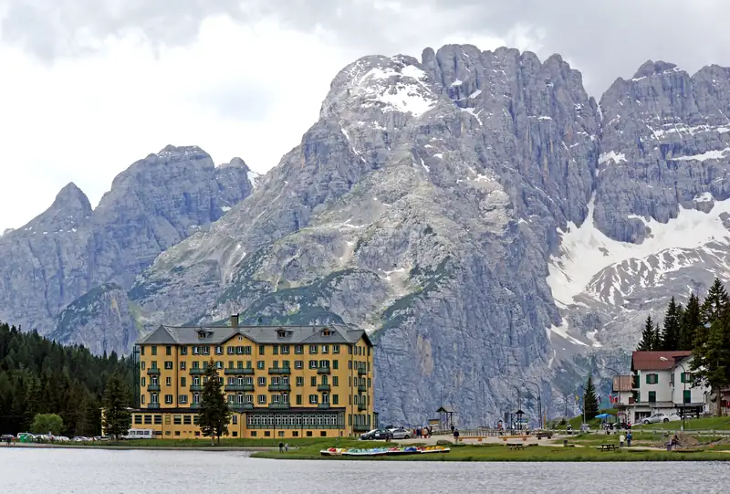
The best-known Misurina story is a folk tale: a spoiled princess, her giant father Sorapiss turned to stone, and a lake made of his tears.
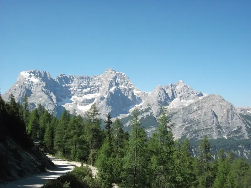
Col de Varda is the Cadini slope above the south end of Lake Misurina.