Starts at Lake Misurina
Hike on the Cadini di Misurina
7 hours
A demanding guided hike straight from the lakeshore into the Cadini spires, 12.7 km with 870 m of climbing, stopping at Rifugio Città di Carpi for lunch.
from$112
Check availability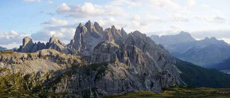
The Cadini di Misurina viewpoint is a short walk from Rifugio Auronzo, the car park at the end of the Tre Cime toll road. Trail 117 gets you there in about 30 to 35 minutes each way, roughly 3 to 4 km return with about 150 to 210 m of climbing. The final stretch runs along a cliff edge.
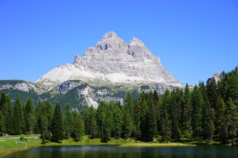
The Cadini di Misurina are the cluster of sharp grey spires east of Lake Misurina. You see them from the lakeshore, but the view most people are after is from the other side: a narrow rocky outcrop near Rifugio Auronzo that looks straight across at the spires. In summer people queue to stand on it for a photo.
The walk to it is short. Getting to the start, and coping with the drop at the end, are the parts to plan.
The Cadini di Misurina are a mountain group in the eastern Dolomites, in the municipality of Auronzo di Cadore, and part of the Dolomites UNESCO World Heritage site. The Tre Cime di Lavaredo lie to the north, Lake Misurina and Monte Cristallo to the west, and the Sorapiss and Marmarole to the south. The highest summit is Cima Cadin di San Lucano at 2,839 m.
The name comes from the local Cadorino word ciadìn, a basin, after the deep hollows and cirques between the peaks (according to dolomiti.it).
The start is Rifugio Auronzo, at 2,320 m, at the top of the Tre Cime toll road.
Figures vary between sources, all of them hiking blogs. Earth Trekkers gives 3.2 km return with 210 m of climbing and 1 to 2 hours. Others give about 3.9 km return and about 144 m of climbing, and 30 to 35 minutes each way. Plan on 1 to 2 hours return including the photo stop.
You need no climbing skills or equipment. The drop is what decides whether this walk is for you.
The final section runs along the top of a cliff. Beyond the main viewpoint the path is narrow and covered with loose gravel, which makes it slippery. Earth Trekkers describes the hike as easy but needing a head for heights, and does not recommend it for anyone afraid of heights or in wet, icy or windy weather. BookATrekking also warns against it for people with vertigo.
Our advice: if the path is wet or the wind is up, enjoy the view from the safer ground before the outcrop and skip the last few metres. The photo is not worth a fall.
The trail is usually free of snow from June to late October. Outside that window the toll road is closed anyway.
There is only one car park at the trailhead: the one at Rifugio Auronzo, at the end of the Tre Cime toll road. In 2026 a car paid €40 and had to book a time slot online before arriving; the ticket covers 12 hours from the booked time (checked October 2026). You cannot arrive before your slot starts, and you cannot leave and come back on the same ticket.
Without a car booking you have two practical options:
The Rifugio Auronzo guide covers both buses and the booking rules in full.
Plenty of people want a Cadini sunrise, and it is the hardest time to get here. The first shuttle from Misurina leaves at 7:30, well after a summer sunrise. That leaves three routes:
Sunset is easier by car, since you can book an afternoon slot. In 2026 the shuttle ran until 20:00, so check the last bus down against the sunset time for your date. On queues, Earth Trekkers found the wait for the photo on the outcrop ranged from almost nothing to an hour or more, and found few people in mid-afternoon. Early and late in the day may help, but there are no guarantees.
Trail 117 carries on past the viewpoint to Rifugio Fratelli Fonda Savio (2,367 m by the hut’s own figure; dolomiti.it gives 2,359 m), on a ridge in the middle of the group. dolomiti.it puts it about 1 hour 45 minutes on foot from Lago d’Antorno. The shorter way up from the Misurina side is trail 115 from Pian dei Spiriti, above the lake: 1 to 1.5 hours and about 470 m of climbing. One hiking blog describes a loop linking Rifugio Auronzo, Fonda Savio and Lake Misurina at about 11.4 km, 590 m of climbing and 4.5 hours.
The Sentiero Alberto Bonacossa is a different matter. It is an equipped trail (a via ferrata with fixed cables) that crosses the Cadini from the south shore of Lake Misurina to the Tre Cime. It needs via ferrata experience, the right kit and a helmet.
On the lake side of the group, a chairlift from the shore of Lake Misurina runs up to Rifugio Col de Varda (2,106 m). In 2026 it ran from 18 June to 20 September, and an adult return cost €17 (checked October 2026). From the hut, trail 120 continues to Rifugio Città di Carpi in about 1 to 1.5 hours, with views of the Cadini from the south.
Both walks start at the same car park, so the viewpoint fits easily into a Tre Cime loop day. The loop takes 3 to 4 hours and the viewpoint 1 to 2, so a 12-hour car slot covers both with time for lunch.
A guided hike on GetYourGuide, Hike on the Cadini di Misurina, starts from the lake at the Col de Varda chairlift and covers 12.7 km with 870 m of climbing, so it suits fit hikers. It is new and had no reviews when we checked. Two Tre Cime tours that start in Misurina include the toll road. More options are on our tours page, and our guide to the best hikes in the Dolomites puts this walk alongside others in the area.
7 hours
A demanding guided hike straight from the lakeshore into the Cadini spires, 12.7 km with 870 m of climbing, stopping at Rifugio Città di Carpi for lunch.
from$112
Check availability5 hours
Meets at Misurina and drives you up the toll road (fee included) for the classic 10 km loop around the Tre Cime from Rifugio Auronzo, with a guide who covers the geology and First World War history.
from$146
Check availability6 hours
An early-start Tre Cime loop for up to four people, leaving from the Misurina car park with the toll included and pausing for breakfast at a mountain hut (food paid on the day).
from$146
Check availabilityPrices and ratings were taken from GetYourGuide and can change. Booking through these links supports this site at no extra cost to you.
The walk is short and has no technical climbing, so most hikers rate it easy. The difficulty is exposure: the final stretch runs along the top of a cliff on a narrow path with loose gravel. It is not a good idea if you suffer from vertigo, and you should skip the last section in wet, icy or windy weather.
From Rifugio Auronzo it is about 30 to 35 minutes each way on trail 117. Hiking blogs give 3.2 to 3.9 km return with 150 to 210 m of climbing. Allow 1 to 2 hours in total, longer in summer when people queue for the photo on the narrow outcrop at the end.
At the Rifugio Auronzo car park at the top of the Tre Cime toll road, the same car park as the Tre Cime loop. Since 2025 you must book a slot online in advance; in 2026 a car paid €40 for 12 hours (checked October 2026). Without a booking, take the Dolomitibus shuttle from Misurina, which cost €10 for a day ticket.
Only with planning. The first shuttle leaves Misurina at 7:30, too late for a summer sunrise. Options are booking an early toll road slot if the calendar offers one, sleeping in your vehicle at the car park on a booked slot (allowed, but camping is not), or walking up trail 101 from Lago d'Antorno in the dark with a head torch.
Yes, but it is a long day. Trail 101 from Lago d'Antorno climbs to Rifugio Auronzo in about 1 hour 45 minutes, and the viewpoint is another 35 minutes beyond. Longer loops through the Cadini via Rifugio Fonda Savio also start near the lake. A guided Cadini hike from the lake shore covers 12.7 km with 870 m of climbing.
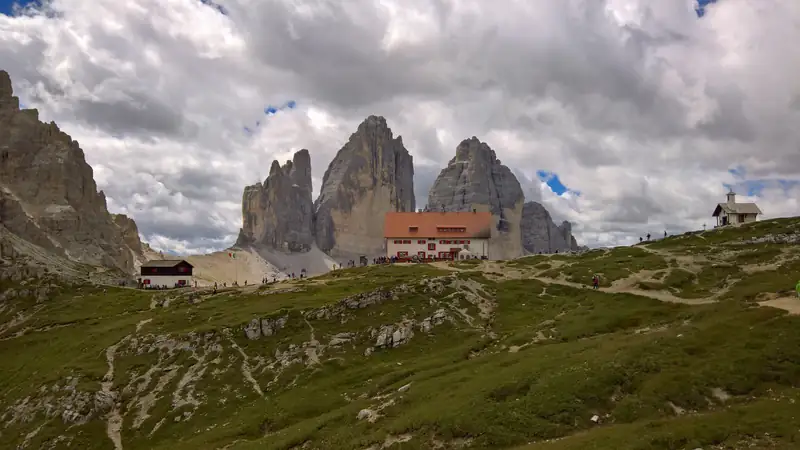
The Tre Cime di Lavaredo loop is a walk of about 9.5 km and 400 m of climbing around three peaks, taking most people 3 to 4 hours.
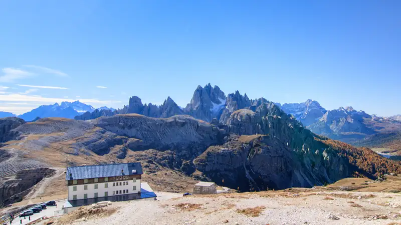
Rifugio Auronzo is the hut and car park at the end of the Tre Cime toll road, 2,320 m up.
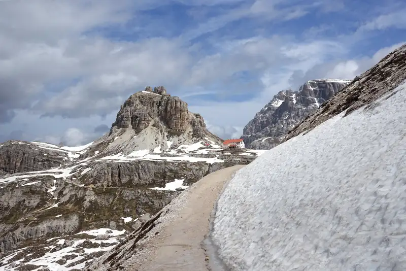
The best hikes in the Dolomites near Misurina are the Tre Cime loop (about 10 km, 3 to 4 hours), the short Cadini di Misurina viewpoint walk and the Lake Sorapis trail (10.5 km, 4 hours, with exposed ledges).
The best-known Dolomites lakes are Braies, Sorapis, Carezza and Misurina.